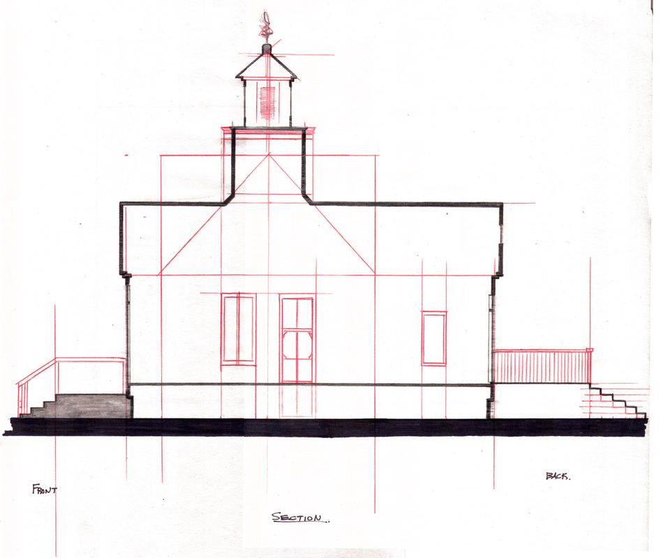
Architectural/Planning Drawing and Studies
Residential House Design (Work In Progress)
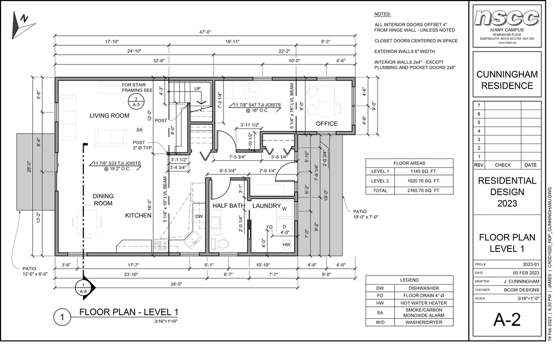
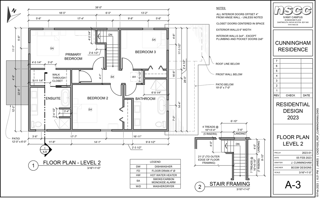
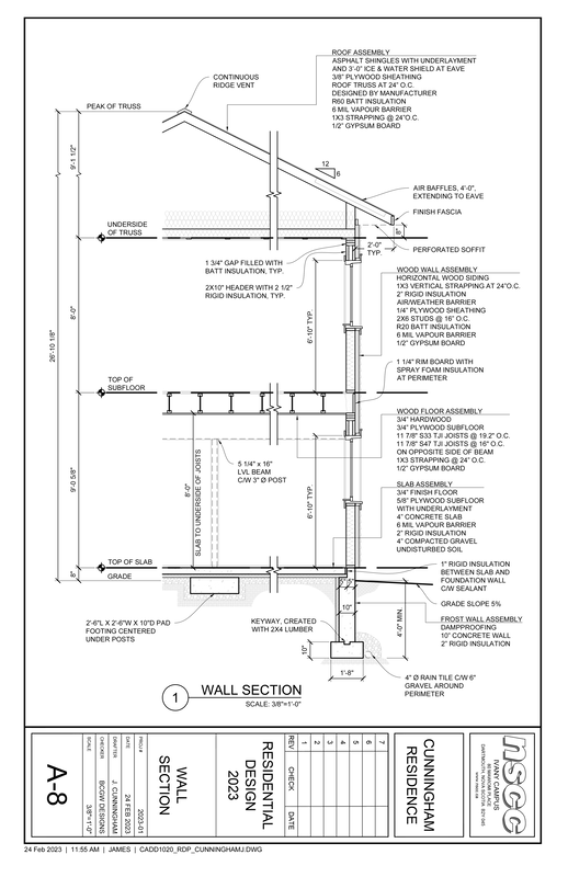
This is an example of my work in progress - residential house design for my Architectural Engineering Technician diploma at NSCC. There is more work to come, however these are my up to date floor plans for levels 1 and 2. Drafted in AutoCAD 2022.
This is an example of my work in progress - residential house design for my Architectural Engineering Technician diploma at NSCC. There is more work to come, however these are my up to date floor plans for levels 1 and 2. Drafted in AutoCAD 2022.
Subdivision Assignment
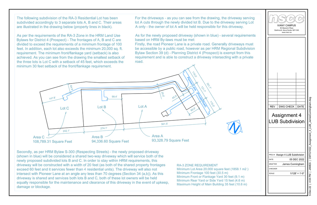
For this assignment we were tasked with subdividing an RA-3 Building Lot within the Planning District 4 (Prospect). I accomplished this by cross-examining applicable planning and subdivision bylaws for HRM and the Prospect District (District 4). Below is an illustration created in AutoCAD 2022 of my solution as well as an explanation of how I arrived there.
For this assignment we were tasked with subdividing an RA-3 Building Lot within the Planning District 4 (Prospect). I accomplished this by cross-examining applicable planning and subdivision bylaws for HRM and the Prospect District (District 4). Below is an illustration created in AutoCAD 2022 of my solution as well as an explanation of how I arrived there.
Site Analysis and Concept Illustration
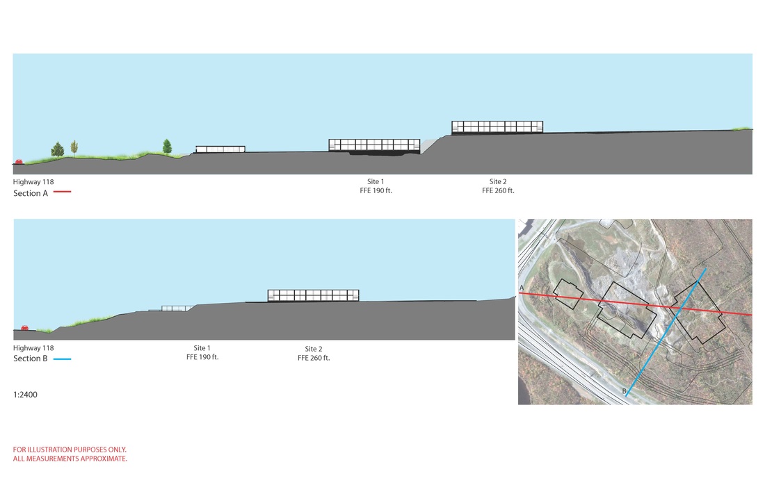
Preliminary work completed to illustrate to IKEA developers how the new IKEA building in Dartmouth Crossing would appear in two locations from Highway 118, driving into Dartmouth. Completed in the first couple of months of 2015.
Preliminary work completed to illustrate to IKEA developers how the new IKEA building in Dartmouth Crossing would appear in two locations from Highway 118, driving into Dartmouth. Completed in the first couple of months of 2015.
Perspective Drawing
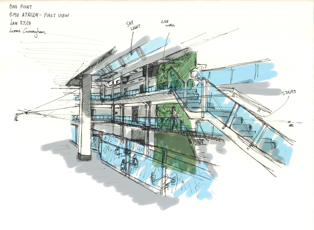
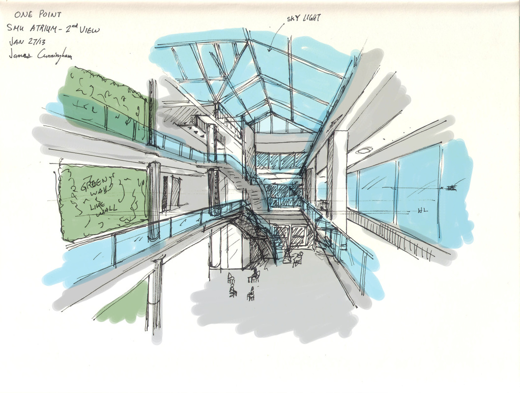
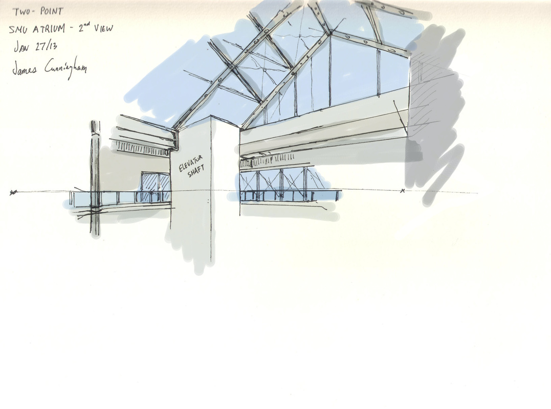
Perspective study of the interior of the Saint Mary's University Atrium
Perspective study of the interior of the Saint Mary's University Atrium
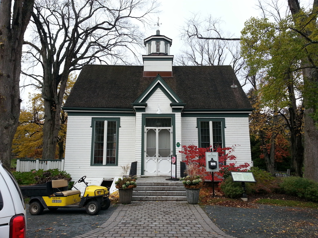
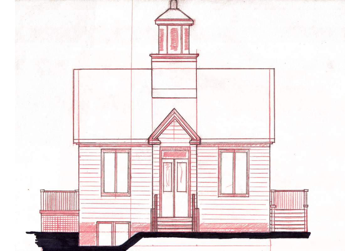
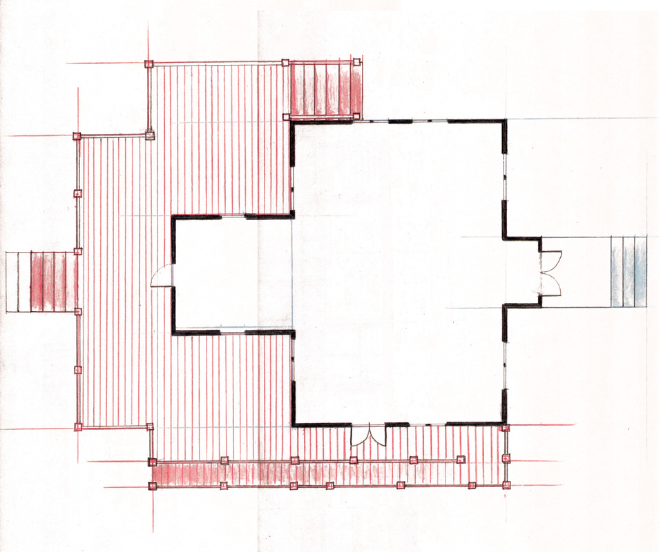
Landscape Design & Hand Drafting
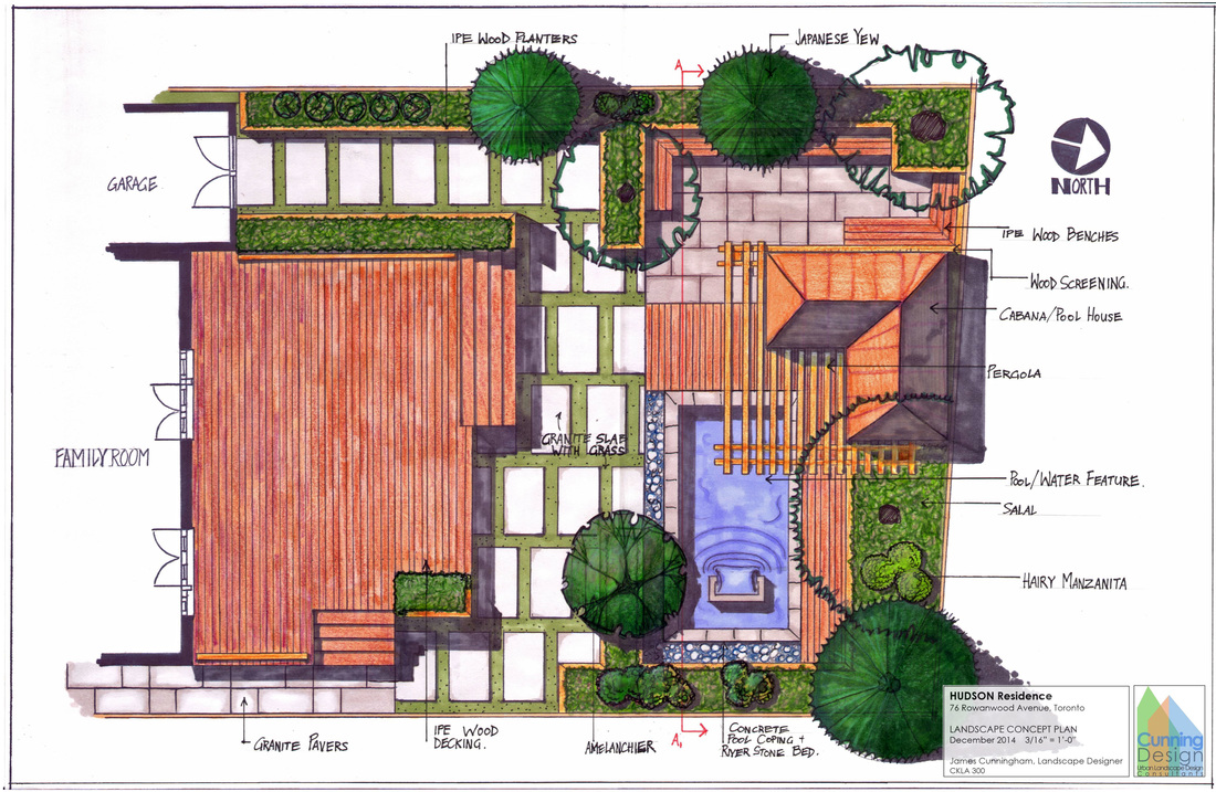
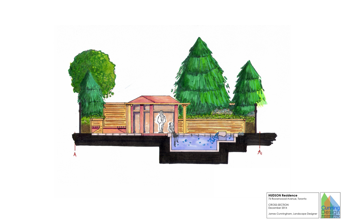
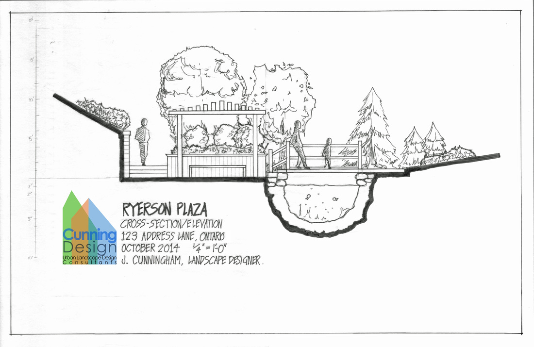
A visual study of the Uncommon Grounds Coffee House in the Halifax Public Gardens.
Geographic Information Systems (GIS)
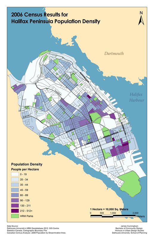
An illustration of the Halifax Peninsula Population Density based on the 2006 Census population data per dissemination area.
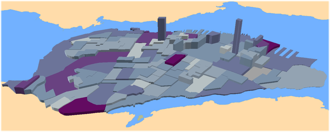
The 3D portion of the map below illustrates the actual population density per dissemination area. The colour represents the actual population level, darker = more population.
An illustration of the Halifax Peninsula Population Density based on the 2006 Census population data per dissemination area.
The 3D portion of the map below illustrates the actual population density per dissemination area. The colour represents the actual population level, darker = more population.